
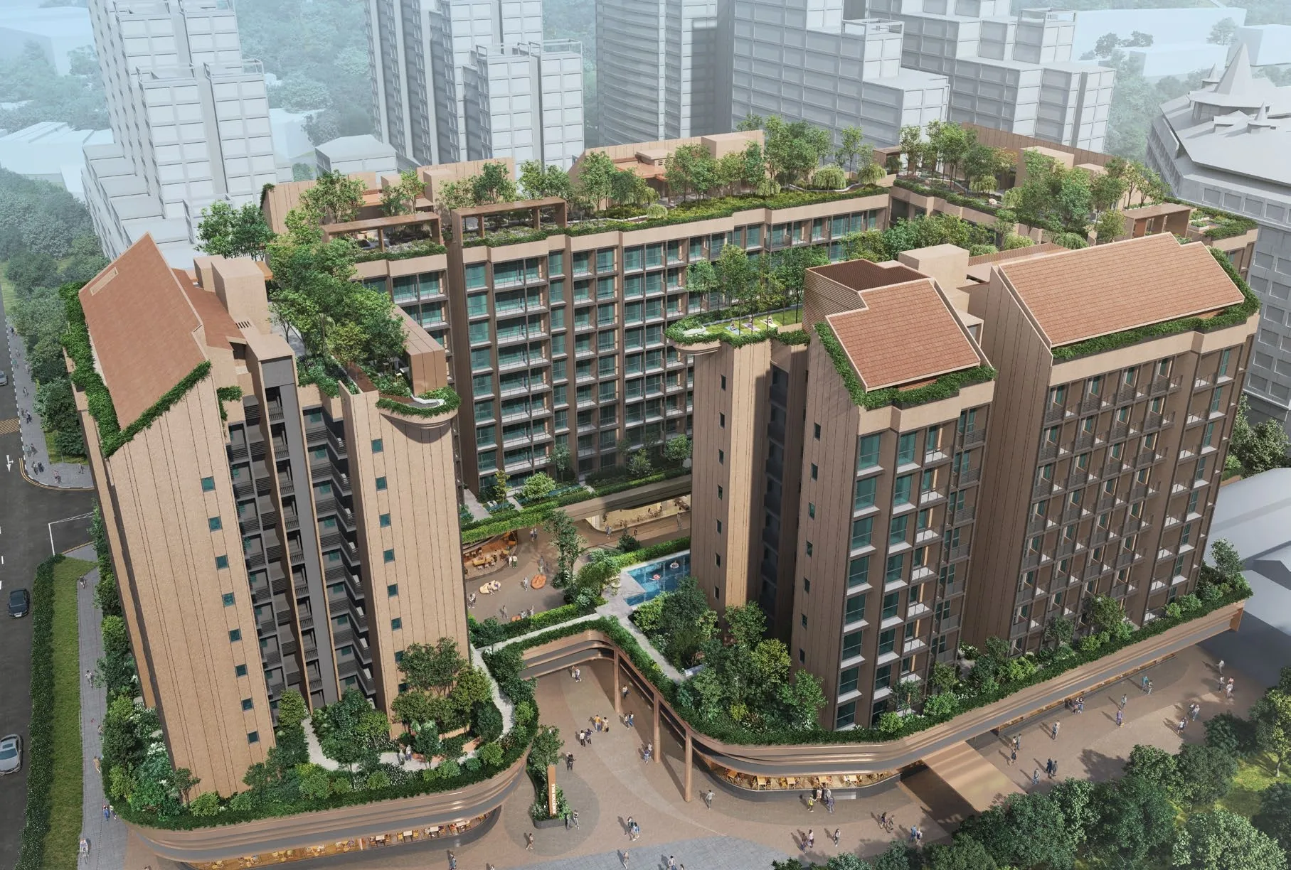
 Artist’s impression
The Robertson Opus stands at 7 to 15 Unity Street at Robertson Quay, District 9. Fort Canning MRT station is about 285 metres away in a straight line, and the Singapore Repertory Theatre is next door.
The Robertson Opus Location Map
Map centred on the site (1.29206, 103.84180). Open The Robertson Opus in Google Maps.
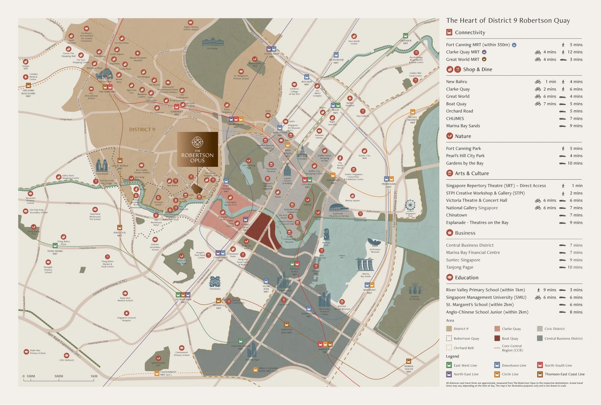
The Robertson Opus fills the block between Unity Street, Merbau Road and Mohamed Sultan Road. To the south, beyond Merbau Road and the theatre, the Singapore River bends past Robertson Quay; to the east rise the green slopes of Fort Canning Hill; to the north, River Valley Road leads towards Orchard Road; and downriver lie Clarke Quay, Boat Quay and the towers of the Central Business District.
The developer’s location map sets the site in the heart of District 9 among the Downtown, North East and Thomson-East Coast Lines, and its table gives travel times: Fort Canning MRT within 350 metres and about five minutes on foot, Clarke Quay about six minutes on foot and Orchard Road about five minutes by car, as approximate figures.
The Robertson Opus Distances
The distances below are straight-line measurements from the site on OneMap; walking routes are longer. They show what lies within reach of The Robertson Opus: the theatre and the river at the door, four MRT stations on four lines, Fort Canning Park and the Civic District.
Within about 700 metres
| Destination | Straight-line distance |
|---|---|
| Singapore Repertory Theatre | about 75 m |
| UE Square | about 100 m |
| RV Point | about 200 m |
| STPI Creative Workshop & Gallery | about 200 m |
| Fort Canning MRT station (DT20) | about 285 m |
| Alkaff Bridge, Singapore River | about 295 m |
| CanningHill Piers | about 325 m |
| Fort Canning Park, the foothills | about 440 m |
| Clarke Quay | about 520 m |
| Clarke Quay MRT station (NE5) | about 670 m |
About 700 metres to 1.7 kilometres
| Destination | Straight-line distance |
|---|---|
| River Valley Primary School | about 710 m |
| Pearl’s Hill City Park | about 910 m |
| Great World MRT station (TE15) | about 920 m |
| Dhoby Ghaut MRT station | about 940 m |
| Great World City | about 1.1 km |
| National Gallery Singapore | about 1.1 km |
| Raffles Place MRT station | about 1.4 km |
| ION Orchard | about 1.7 km |
Measured on OneMap (SLA) from the site. OneMap walking routes need an account and are not given here; walking times quoted elsewhere on this site are the developer’s brochure figures. Home-school distance for Primary One registration is determined by the Ministry of Education.
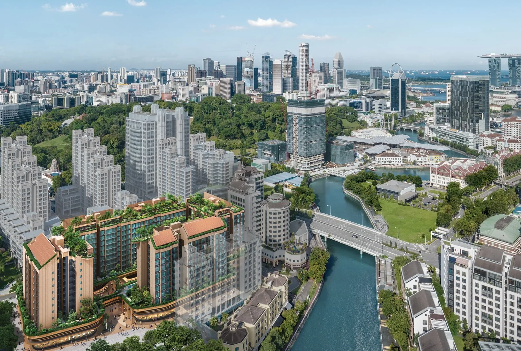
The neighbourhood around The Robertson Opus
Robertson Quay is the most residential of the three quays: its riverbanks are lined with apartments, hotels such as the InterContinental Singapore Robertson Quay, cafes and restaurants, and arts venues such as the Singapore Repertory Theatre and STPI. A continuous promenade runs along both banks of the river towards Clarke Quay and Boat Quay, crossing at bridges such as Alkaff Bridge.
Around it, the city is close: UE Square and RV Point are within about 200 metres, Great World City about 1.1 kilometres away and ION Orchard about 1.7 kilometres, while Raffles Place is about 1.4 kilometres downriver.
Five area guides look further: Robertson Quay and the river, MRT and transport, Fort Canning and the parks, the arts and the Civic District and schools nearby.
Request The Robertson Opus Price List
The Robertson Opus is open for sale, and the Sales Concierge sends the current price list with the homes still available. Showflat viewings are arranged by appointment through the Sales Concierge.
Sent on request
- The current price list with the homes still available.
- The e-brochure and the floor plans you shortlist.
- A payment schedule and the stamp duty for your profile.
- A showflat appointment at a time that suits you.
Request the Price List
No obligation. The Sales Concierge responds personally to every enquiry.
Prefer to speak to someone? Call +65 6200 6220, or send a WhatsApp message to the same number.